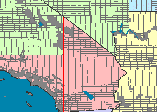
PLSS map is a systematic land partitioning system. The initial point is the basis for the grid, and the principal meridian (north-south line) and baseline (east-west line) extend perpendicularly from this initial point. This map displays PLSS townships in Southern California, with the north-south line being the San Bernardino principal meridian from which the pink townships belong (have been surveyed from). The other townships have different initial points, and the gray areas are not part of the system (either because they have difficult terrain, or because they have special grants).
No comments:
Post a Comment